


Low pressure likely over top of bay of Bengal
Low pressure likely over top of bay of Bengal
 admin
admin
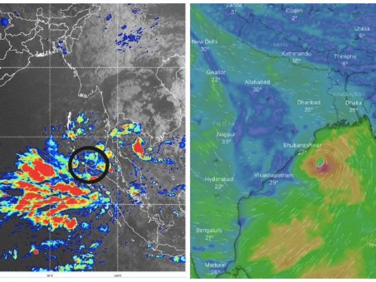
Bhubaneswar: A low-pressure area is expected to emerge over the same region by Friday under the influence of the cyclonic circulation over the South Andaman Sea and its surroundings, according to the Bhubaneswar Meteorological Department (IMD).
In the next 48 hours, the system is expected to strengthen into a depression and move north-westward.
"The chances of a storm forming are best in May. Only after a low-pressure area has formed can its likely route and radius of impact be mapped," said IMD DG Mrutyunjaya Mohapatra.
The current parameters, such as the sea surface temperature, are favourable for the formation of a cyclonic storm, according to Sarat Sahu, head of SOA University's Centre for Environment and Climate (CEC). He did say, though, that on May 7, more clarity about the approach and intensity will emerge.
"An increasing genesis potential points to the emergence of tropical cyclones over the Bay of Bengal." Increased cyclogenesis odds predict that the storm category will be upgraded further, as it will travel over warm ocean waters under favourable climatic conditions. The longer the stay, the more likely this weather system will continue to increase incrementally over the next three days, according to the Skymet meteorological agency.
Low pressure is predicted to form in the Andaman and Nicobar Islands on Friday, according to Senior Meteorologist Jason Nicholls. "This weekend or early next week, it might develop into a depression or cyclone over the Bay of Bengal." "Areas ranging from Andhra Pradesh to West Bengal and Bangladesh must keep an eye on potential consequences," he added.
Storms are threatening Myanmar, Bangladesh, West Bengal, and Odisha in particular during the month of May. The Bay of Bengal has seen six storms between 2011 and 2021, including the exceptionally severe cyclonic storm 'Fani,' which made landfall in Odisha near Puri on May 3, 2019, with winds of 175-185 kmph gusting up to 205 kmph.
On May 21, 2020, Amphan slammed into West Bengal, about 20 kilometres east of Sagar Island in the Sunderbans, with winds gusting to 185 kilometres per hour. On May 26, the next year, cyclone Yaas slammed Odisha's northern coastline with strong winds and rainfall, making landfall near Bahanaga block with sustained winds of 130 to 140 kmph and gusts up to 155 kmph.
The other three tropical storms that affected Bangladesh around Chittagong were Viyaru (2013), Roanu (2016), and Mora (2017).